MOUNTAINS EMERGENCY SERVICE NUMBER
 In Slovakia we have mountains emergency service in the mountains, you can call the number:
18 300
If this number doesn't work, simply call 112 and explain to them where you are situated, they will contact the mountains emergency service.
Please be sure you are insured, since the fees for mountain rescue are extremely high (in thousands of euros).
European emergency number 112 is callable even without a mobile signal.
HIKING MAPS APPLICATION
 Hello guys, the first thing you should know is which app is the best for hiking paths.
On Mapy.com you can find all hike paths not only in Slovakia and Czechia, but all over the world.It is possible to download maps and then use them offline - this is very helpful in the wild without a mobile signal.
You can find the app on Google Play as well as on Apple Store.
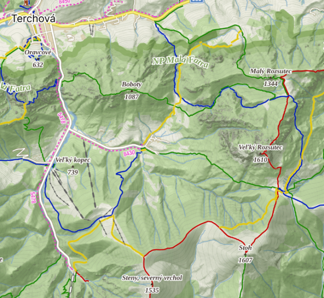
PATHS MARKING
In Slovakia we have usually very well-marked routes. There are of 4 colors, each color has different meaning (and it is not about difficulty of the path):
Red - the main route of the mountains chain. It usually connects all main peaks of the mountain range, or more ranges together
Blue - important regional path, which is always within one mountain chain
Green - path that connects valleys with more important paths (blue and red)
Yellow - easier, shorter paths, which can have cultural meanin
PATH CLOSURES
Because of unpleasant weather and fauna/flora protection, some paths are closed, namely:
- Vysoké Tatry (High Tatras) - the majority of the hiking paths (especially for higher peaks) are closed from 1st of November until 31st of May
- Malá Fatra - three selected paths are closed from 1st of March until 15th of June. Some paths are usually under snow in the winter, so there are winter paths marked with big wood sticks
- Nízke Tatry (Low Tatras) - few paths are closed from 1st of October until 30th of June
These closures are usually reflected in Mapy.com. Please, respect these limitations.